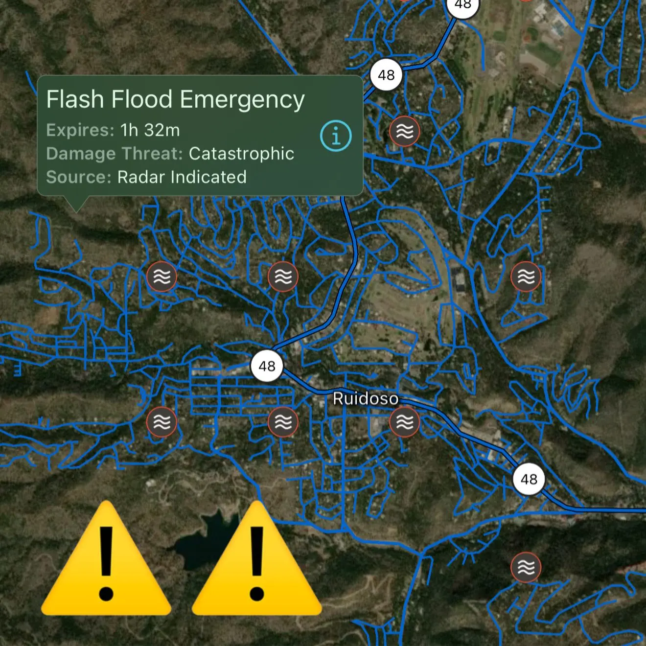
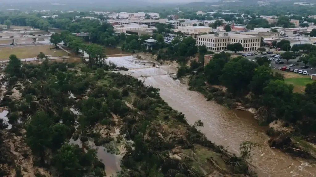
A sudden flash flood emergency has struck the mountain village of Ruidoso, New Mexico, following intense monsoon rains over areas scorched by last year’s South Fork and Salt wildfires. The Rio Ruidoso surged nearly 20 feet in just 30 minutes, sweeping homes and vehicles downstream and triggering dozens of swift-water rescues.
Is New Mexico Flooding Right Now?
Yes. The National Weather Service (NWS) issued an urgent flash flood emergency for the Ruidoso region after heavy rainfall triggered dangerous conditions—prompting an immediate evacuation order to “seek higher ground now”.
What Caused the New Mexico Flooding?
Experts cite a combination of monsoon moisture, uneven terrain, and post-wildfire burn scars, which prevented soil absorption and rapidly channeled water into the river. The NWS observed around 1.5–2.5 inches of rain falling during the storm, which overwhelmed the terrain.
The burned landscape, lacking vegetation, funneled rainwater and debris directly into communities, causing the unprecedented flood surge.
Impact and Response To The Flooding in New Mexico
-
85+ swift-water rescues were carried out as residents were trapped in homes and vehicles, although fortunately no fatalities have been reported so far.
-
Remarkably, one entire home was carried away by floodwaters, along with massive mud and debris flows.
-
Streets and bridges are closed, with the Ruidoso Community Center, ENMU‑Ruidoso, and the Angus Church in Capitan opening as temporary shelters.
Local officials are urging residents to stay out of flood zones and monitor updates via official channels.
New Mexico Flooding Map
A growing New Mexico flooding map shows Ruidoso and nearby communities—Hollywood, Alto, Ruidoso Downs, and Galivan Trailer Park—as crisis zones. The flash flood warning covers burn scars to the east and south, extending to highways and downstream areas in Lincoln County.

These burn scar areas are particularly vulnerable to flash floods because loss of vegetation means rainwater runs direct into communities. The link between wildfires and flooding has never been clearer. The South Fork and Salt Fires in June 2024 razed more than 1,400 structures. Those burn scars hardened the soil, preventing rainfall absorption and magnifying flood risks—a phenomenon repeatedly seen in wildfire‑impacted regions.
Flood Prone Landscape
Ruidoso has faced repeated flooding, especially after the massive South Fork Fire in June 2024, which destroyed over 1,400 structures. The scorched terrain has since led to annual flood risks, with this year’s surge reportedly surpassing last year’s 15 feet peak.
The community had invested in floodplain and debris-control measures earlier this spring, anticipating such events.
Flash Flood Damage Updates
-
Officials report three injuries, all in stable condition.
-
Floodwaters trapped residents in vehicles, homes, and in trailer parks like Gavilan Trailer Park, prompting extensive rescue.
-
While initial estimates on structural damage are pending, losses include washed-out homes, damaged infrastructure, and debris-laden roads.
-
There are no reported fatalities at this time, though rescue operations continue overnight.
What to Do If You’re in Affected Areas
The NWS and first responders strongly urge:
-
Seek higher ground immediately; never drive through floodwaters.
-
Avoid crossing flooded roads—even shallow water can sweep vehicles away (“Turn Around, Don’t Drown”)
-
Use official tools: the Ruidoso flooding map and website to track road closures.
-
Shelter at designated centers and await all-clear notices before returning home.
The current Ruidoso flood emergency highlights the acute vulnerability of post-wildfire landscapes to sudden weather events. With is New Mexico flooding right now? confirmed as “yes” in Ruidoso, the region remains on high alert. Authorities continue rescue operations, infrastructure assessments, and community support across evacuation centers.
Residents are reminded: monitor weather updates, adhere to official warnings, and stay informed via flood maps and local advisories.


