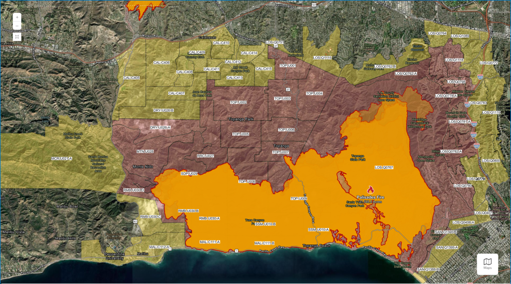
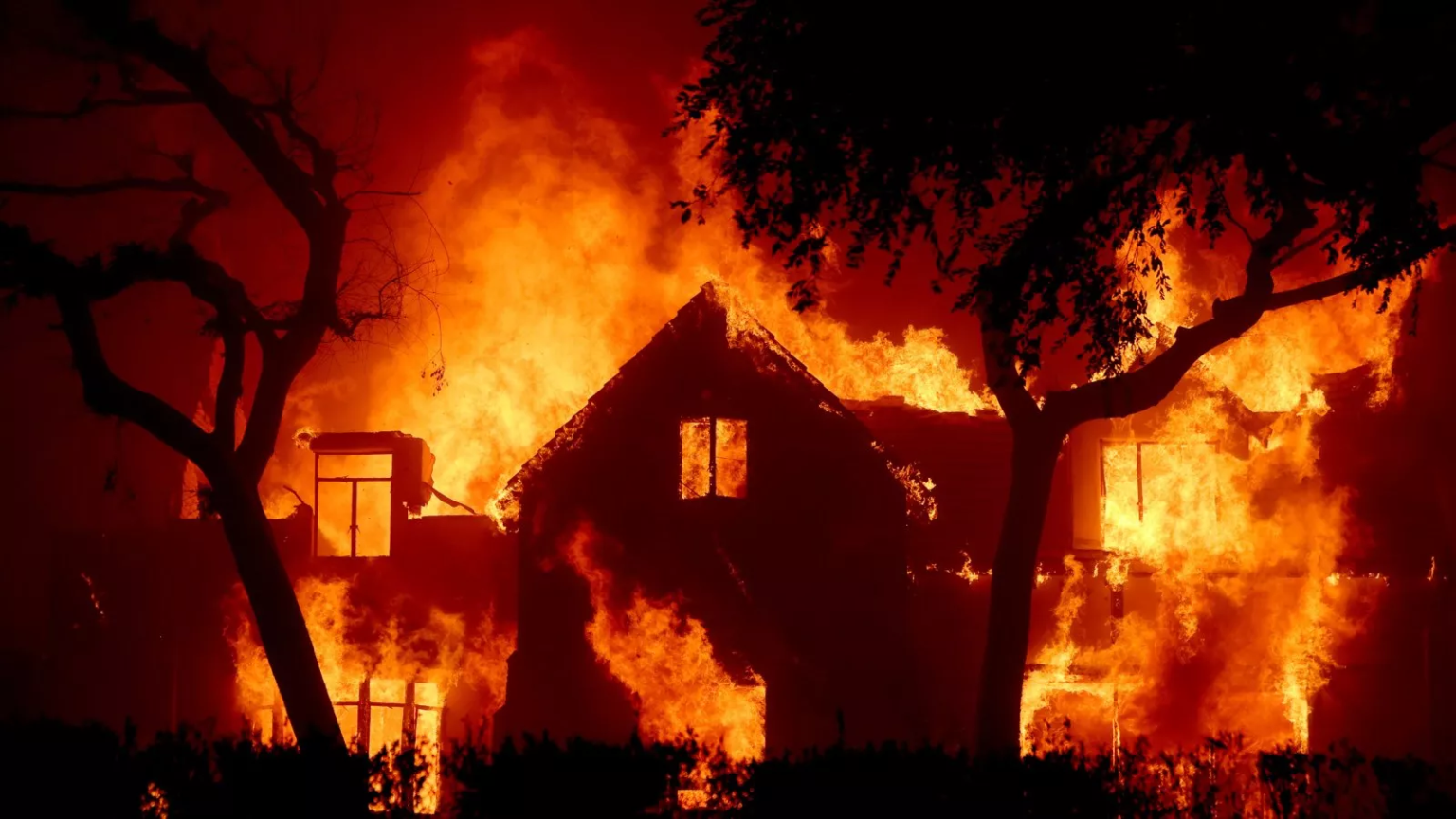
The devastating Palisades Fire continues to expand, forcing new evacuation orders in Encino and nearby areas. With over 21,000 acres scorched and containment at only 8%, residents are urged to remain vigilant as the fire threatens homes, businesses, and lives across Southern California.
Where Is Encino?
Encino is a neighborhood located in the San Fernando Valley, part of Los Angeles, California. Nestled north of the Santa Monica Mountains, Encino is known for its tranquil residential areas and proximity to scenic parks. Unfortunately, its location places it in the path of the Palisades Fire, which has spread rapidly due to dry conditions and strong winds.
Encino Fire Evacuation Orders
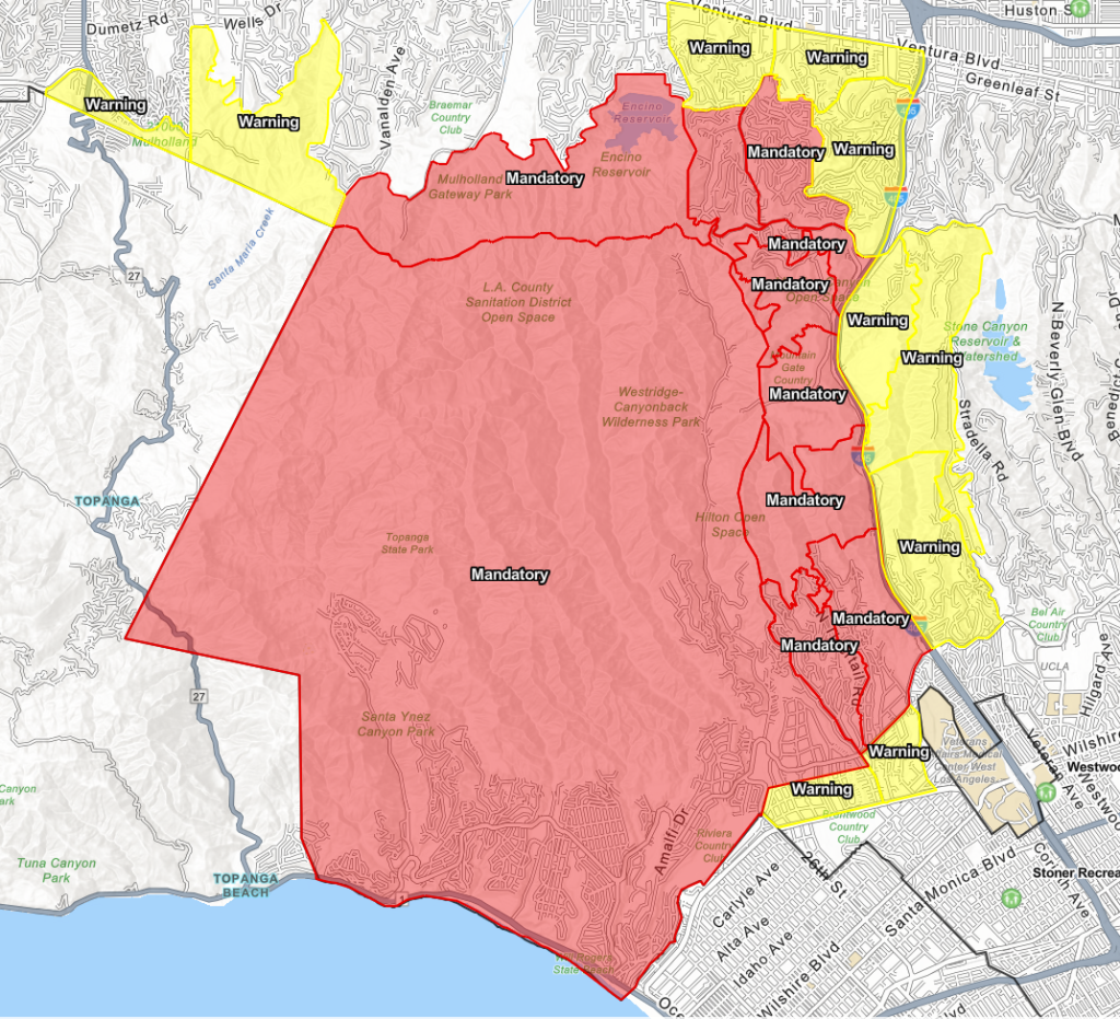
Late Friday night, mandatory evacuation orders were expanded to include parts of Encino as the Palisades Fire grew more aggressive. The evacuation zone covers:
- South: Sunset Boulevard
- North: Encino Reservoir
- East: 405 Freeway
- West: Mandeville Canyon
Residents in these areas are urged to evacuate immediately. Those in surrounding regions should stay alert to evolving evacuation warnings.
Encino Evacuation Map

The Los Angeles Fire Department (LAFD) has provided an interactive evacuation map that is regularly updated. This map shows mandatory evacuation zones, areas under warnings, and other critical details.
Evacuation Shelters for Encino Residents
For those affected by the Encino fire evacuation, several shelters have been set up to provide safety and resources:
- Van Nuys Recreation Center: 14301 Vanowen St., Van Nuys, CA
- Lanark Recreation Center: 21816 Lanark St., Canoga Park, CA
- Westwood Recreation Center: 1350 South Sepulveda Blvd., Los Angeles, CA
- Pasadena Convention Center: 300 E Green St., Pasadena, CA
Residents evacuating with pets can take them to the Agoura Animal Shelter for care.
Road Closures Impacting Evacuations
Firefighting efforts and public safety concerns have led to numerous road closures in the Encino area and beyond:
- 405 Freeway: Several off-ramps, including Skirball Center Drive and Getty Center Drive, are closed.
- Pacific Coast Highway (PCH): Closures extend from Malibu Canyon to Civic Center.
- Topanga Canyon Boulevard: Fully closed between PCH and Mulholland Drive.
Travelers are advised to avoid these routes and use alternate paths when possible.
The Palisades Fire at a Glance

The Palisades Fire, which ignited on January 7, has become one of Los Angeles’ most destructive wildfires. Here’s what we know so far:
- Acreage Burned: 21,596 acres
- Containment: 8%
- Structures Destroyed: Over 5,000, including homes and businesses
- Lives Lost: At least five fatalities confirmed
- Evacuations: More than 30,000 residents displaced
The fire’s rapid spread is being fueled by dry vegetation and strong Santa Ana winds, creating unpredictable and dangerous conditions.
Encino Evacuation Preparation
If you are in or near the evacuation zone, take these steps to protect yourself and your family:
- Stay Informed: Monitor local news and official resources for updates.
- Pack Essentials: Prepare a go-bag with necessities like medications, important documents, clothing, and supplies for pets.
- Follow Orders: Do not delay evacuation if directed to leave. Fire conditions can escalate quickly.
Ongoing Firefighting Efforts
Firefighters are working around the clock to combat the Palisades Fire, deploying aerial tankers and ground crews to slow its advance. However, steep terrain and shifting winds present significant challenges. Weather forecasts predict that winds may calm temporarily over the weekend, but fire officials warn that critical fire weather conditions could persist into next week.
The Encino fire evacuation highlights the severity of the Palisades Fire and its far-reaching impact. With thousands displaced and containment efforts ongoing, residents must prioritize safety and remain alert to changing conditions.
For up-to-date information on evacuation zones, visit the LAFD Evacuation Map. Stay safe, and follow official guidance as we navigate this crisis together.


