


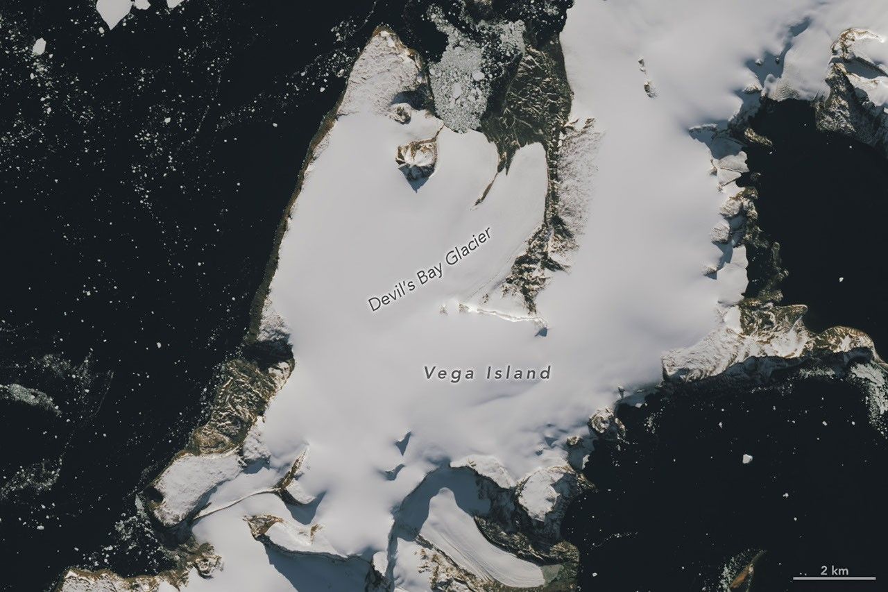
Distinctive ice formations on Vega Island in the Weddell Sea have drawn attention for their resemblance to a human skull in profile. New satellite imagery from NASA’s Earth Observatory highlights the stark contrast between winter snow cover and the bare ice exposed during the austral spring, offering a visual record of changing climate conditions in the region.
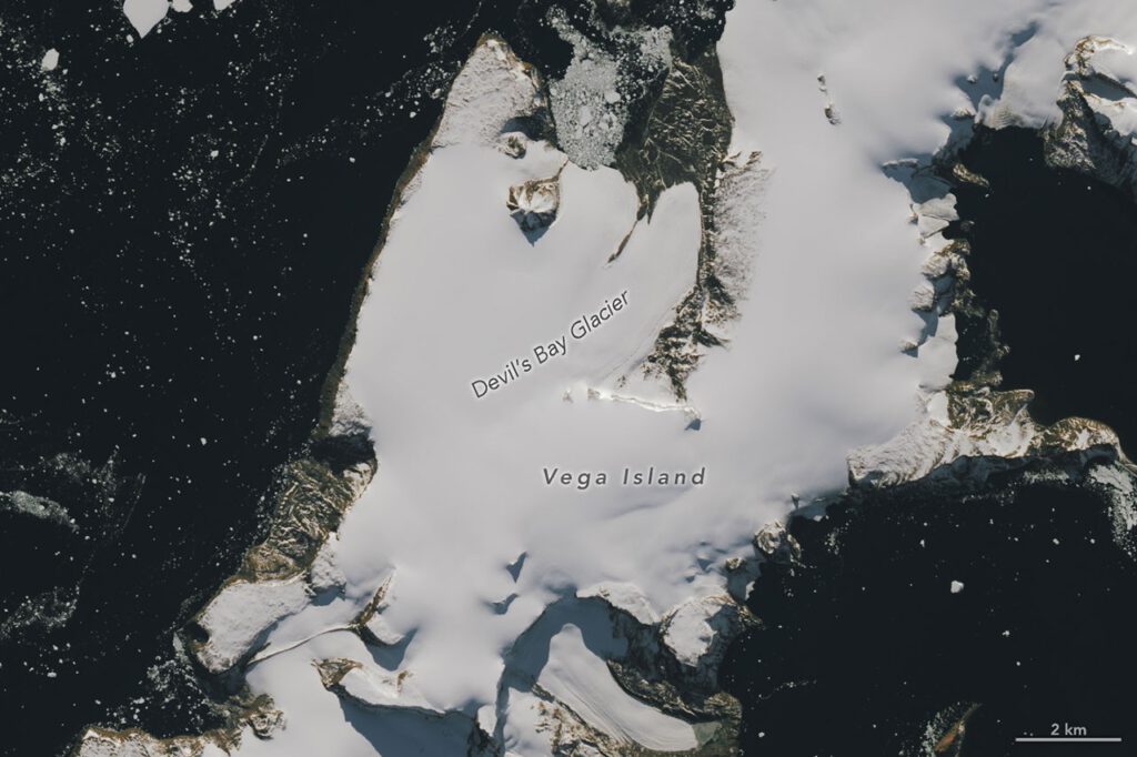
The images, captured by the Operational Land Imager on Landsat 9, show the island on March 22, 2025, and October 10, 2026. The March 2025 photo displays a layer of snow typical of the region’s wettest month. The October 2026 image reveals large areas of dark ice where snow has melted or failed to accumulate. Clouds obscured the island in March 2026, leaving a gap in the seasonal record.

Ice Loss and Temperature Anomalies
Mauri Pelto, a glaciologist at Nichols College, attributed the extensive bare ice visible in the October 2026 image to above-average temperatures during the winter of 2026, particularly in June. The lack of snow cover reduces the surface’s ability to reflect solar energy. Darker ice absorbs more heat, which accelerates the melting process as days lengthen and temperatures rise.
“The winter season was no treat for these glaciers,” Pelto said. He noted that sublimation and wind scouring further reduced snow accumulation. A thin layer of new snow from a spring storm could provide temporary relief by reflecting sunlight, but the underlying trend points toward increased melt.
The visual features that create the skull-like appearance are formed by natural geological structures. A nunatak, or rocky peak protruding from the ice, resembles an eye socket. A lateral moraine forms the mouth, and the Bahía del Diablo, or Devil’s Bay, Glacier creates the jawbone. As the ice melts, these features will shift, altering the landscape’s appearance.
Historical Context and Glacial Monitoring
Scientists have tracked changes on Vega Island for decades. Early mapping efforts in 1982 used Landsat imagery, aerial photographs, and topographic maps to catalog 29 glaciers on the island. Since the austral summer of 1998-1999, researchers have closely monitored the Devil’s Bay Glacier, documenting a consistent decline in its mass. Satellite data from recent years show similar ice loss across other glaciers on the island, with increasing areas of exposed bedrock.
The island also holds a place in the history of Antarctic exploration. During the Swedish Antarctic Expedition of 1901-1903, the party became separated into three groups during the winter. Their ship was trapped and crushed by pack ice, leaving the explorers isolated. Cape Well-met, located near the “forehead” of the ice formation, served as the reunion point for two of the groups in the spring of 1903. An Argentinean expedition later rescued the survivors.
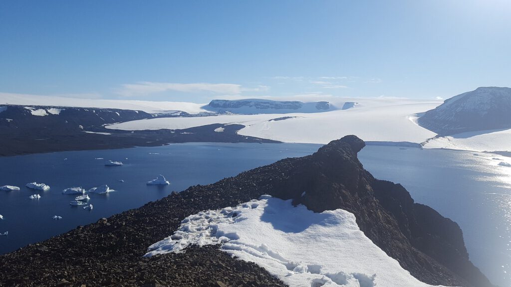
The current imagery continues the long record of monitoring Vega Island’s ice dynamics. The contrast between the snow-covered winter and the bare ice of spring provides a clear indicator of the region’s response to warming temperatures. The exposed ice surfaces serve as a tangible record of the environmental shifts occurring in the Weddell Sea.
Source: NASA
